Tutorials
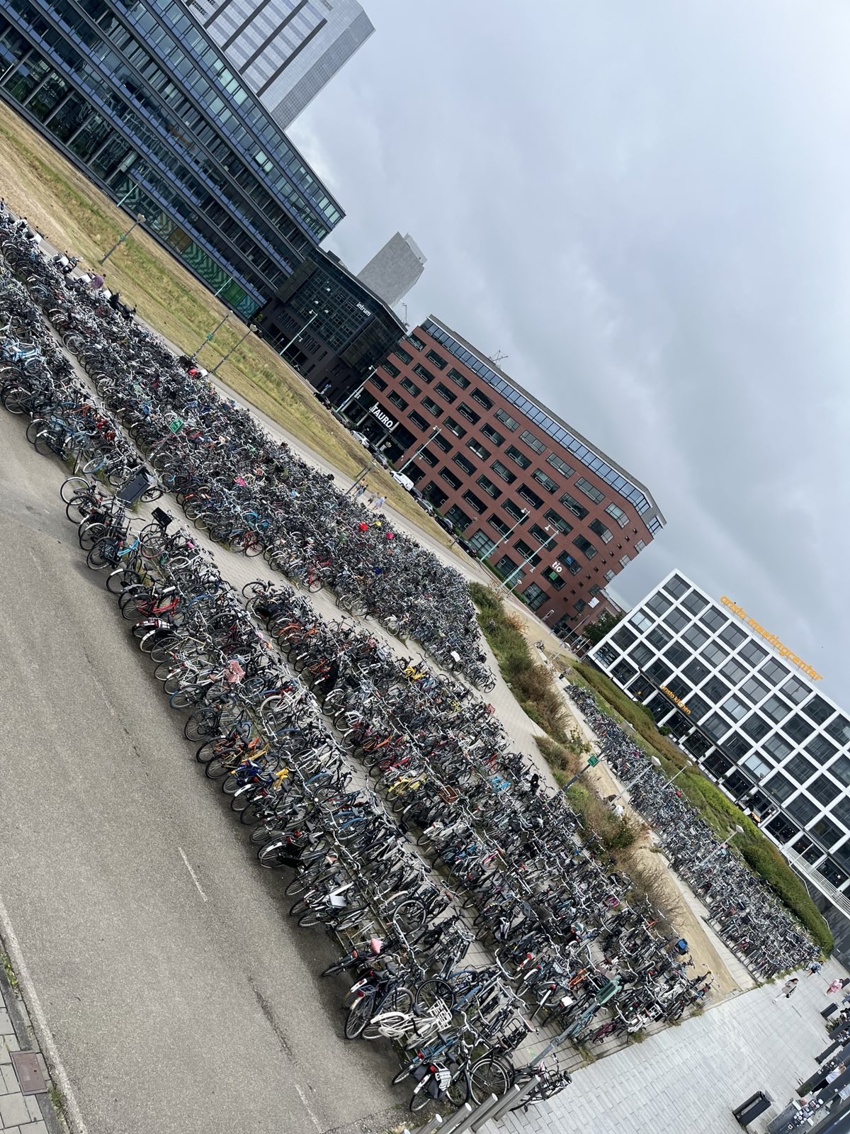
1. instructions2. example3. videos4. techniques5. glossary6. functionality7. collaboration8. aboutLet's do it together We have an image that was taken in Amsterdam, The Netherlands, and our goal is to pinpoint the exact location where it was captured.
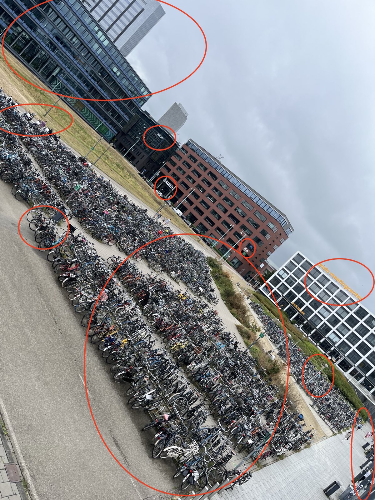
Look at this image and make a list of 10 geospatial elements you can recognize in it. For example, street signs, restaurant names, parks, trains. If you want to challenge yourself, go till 20 hints. If the visual is of low quality, enhance it.

We start by visually analyzing the image and identifying 10 geospatial elements.

Our search area is Amsterdam. Use the first two hints from your list and start writing your prompt. So, we'll look for all bike parking spots near a train station using the prompt:
"Please find a parking for bikes next to a train station in Amsterdam." (follow the steps here)
As expected, this yields a lot of results. Now, let's refine our search. We will narrow it down by looking for bike parking in front of a meeting center. Update the prompt to:
"Please find a parking for bikes next to a train station and in front of a meeting center in Amsterdam." (follow steps here)
With this refinement, we are left with only a few results. Now, check these for all matching criteria, using the shape on the satellite map layer as one of many clues. Voilà, you've found the location!